Back مقاطعة سان دييغو (كاليفورنيا) Arabic سان دييجو كاونتى (كاليفورنيا) ARZ Condáu de San Diego AST San-Dieqo qraflığı (Kaliforniya) AZ County San Diego, California BAN San Diego County, Kalifornien BAR Сан-Дыега (акруга) BE Сан Диего (окръг) Bulgarian স্যান ডিয়েগো কাউন্টি, ক্যালিফোর্নিয়া Bengali/Bangla সান ডিয়েগো কাউন্টি, ক্যালিফোর্নিয়া BPY
San Diego County | |
|---|---|
| County of San Diego | |
|
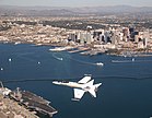
From top down and left to right: F/A-18 Hornet flying over San Diego, Mission San Diego de Alcalá, San Diego State University's Hepner Hall, Hotel del Coronado, Torrey Pines State Natural Reserve, Jacumba Mountains | |
 Interactive map of San Diego County | |
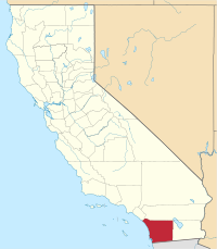
 Location in the state of California | |
| Coordinates: 33°01′N 116°46′W / 33.02°N 116.77°W | |
| Country | United States |
| State | California |
| Formed | February 18, 1850[1] |
| Named for | San Diego de Alcalá |
| County seat | San Diego |
| Largest city | San Diego |
| Government | |
| • Type | Council–CEO |
| • Body | Board of Supervisors |
| • Chair | Nora Vargas (D) |
| • Vice Chair | Terra Lawson-Remer (D) |
| • Chair Pro Tem | Joel Anderson (R) |
| • Board of Supervisors[3] | |
| • Chief Administrative Officer | Sarah E. Aghassi (Interim)[2] |
| Area | |
| • Total | 4,260.9 sq mi (11,036 km2) |
| • Land | 3,942 sq mi (10,210 km2) |
| • Water | 319 sq mi (830 km2) |
| Highest elevation | 6,536 ft (1,992 m) |
| Population | |
| • Total | 3,298,634 |
| • Density | 837/sq mi (323/km2) |
| GDP | |
| • Total | $257.341 billion (2022) |
| Time zone | UTC–8 (Pacific Time Zone) |
| • Summer (DST) | UTC–7 (Pacific Daylight Time) |
| Area codes | 442/760, 619/858, and 949 |
| FIPS code | 06-073 |
| Congressional districts | 48th, 49th, 50th, 51st, 52nd |
| Website | www |
San Diego County (/ˌsæn diˈeɪɡoʊ/ ⓘ), officially the County of San Diego (Spanish: Condado de San Diego), is a county in the southwestern corner of the U.S. state of California. As of the 2020 census, the population was 3,298,634,[7] making it California's second-most populous county and the fifth-most populous in the United States. Its county seat is San Diego,[8] the second-most populous city in California and the eighth-most populous city in the United States. It is the southwesternmost county in the 48 contiguous United States, and is a border county. It is also home to 18 Native American tribal reservations, the most of any county in the United States.
San Diego County comprises the San Diego-Chula Vista-Carlsbad, CA Metropolitan Statistical Area,[9] which is the 17th most populous metropolitan statistical area and the 18th most populous primary statistical area of the United States as of July 1, 2012.[10][11] San Diego County is also part of the San Diego–Tijuana transborder metropolitan area, the largest metropolitan area shared between the United States and Mexico.
San Diego County has more than 70 miles (113 km) of coastline. This forms the most densely populated region of the county, which has a mild Mediterranean to semiarid climate and extensive chaparral vegetation, similar to the rest of the western portion of Southern California. Precipitation and temperature extremes increase to the east, with mountains that receive frost and snow in the winter.[12] These lushly forested mountains receive more rainfall than the average in Southern California, while the desert region of the county lies in a rain shadow to the east, which extends into the Desert Southwest region of North America.
There are 16 military installations, of the U.S. Navy, U.S. Marine Corps, and U.S. Coast Guard in San Diego County. These include Naval Base San Diego, Marine Corps Base Camp Pendleton, Naval Air Station North Island, Marine Corps Air Station Miramar, and Coast Guard Air Station San Diego.
From north to south, San Diego County extends from the southern borders of Orange and Riverside Counties to the Mexico-U.S. border and the Baja California municipalities of Tijuana and Tecate. From west to east, San Diego County stretches from the Pacific Ocean to its boundary with Imperial County, which separated from it in 1907. Since 2010, statewide droughts in California have further strained San Diego County's water security.[13]
- ^ "Chronology". California State Association of Counties. Retrieved February 6, 2015.
- ^ "Chief Administrative Officer". County of San Diego. Retrieved January 31, 2015.
- ^ "Board of Supervisors". County of San Diego. Retrieved January 12, 2015.
- ^ "Home". sangis.org.
- ^ "Hot Springs Mountain". Peakbagger.com. Retrieved January 31, 2015.
- ^ "Gross Domestic Product by County and Metropolitan Area, 2022" (PDF). www.bea.gov. Bureau of Economic Analysis.
- ^ Cite error: The named reference
QF2020was invoked but never defined (see the help page). - ^ "Find a County". National Association of Counties. Retrieved June 7, 2011.
- ^ "OMB Bulletin No. 13-01: Revised Delineations of Metropolitan Statistical Areas, Micropolitan Statistical Areas, and Combined Statistical Areas, and Guidance on Uses of the Delineations of These Areas" (PDF). United States Office of Management and Budget. February 28, 2013. Archived (PDF) from the original on January 21, 2017. Retrieved March 20, 2013.
- ^ "Table 1. Annual Estimates of the Population of Metropolitan and Micropolitan Statistical Areas: April 1, 2010 to July 1, 2012". 2012 Population Estimates. United States Census Bureau, Population Division. March 2013. Archived from the original (CSV) on April 1, 2013. Retrieved March 20, 2013.
- ^ "Table 2. Annual Estimates of the Population of Combined Statistical Areas: April 1, 2010 to July 1, 2012". 2012 Population Estimates. United States Census Bureau, Population Division. March 2013. Archived from the original (CSV) on May 17, 2013. Retrieved March 20, 2013.
- ^ "climate map". Koeppen-geirger.vu.
- ^ "Rainfall Totals: March Rain Not Enough to Pull from Drought, Expert Says". www.nbcsandiego.com. Retrieved May 1, 2022.


