Back حدود روسيا الاتحادية Arabic Рәсәйҙең дәүләт сиге BA Fronteras de Rusia Spanish Frontières de la Russie French Oroszország határai Hungarian Ռուսաստանի սահմաններ HY ロシアの国境 Japanese Граници на Русија MK Russlands riksgrense NB روس دیاں سرحداں PNB


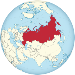
Russia, the largest country in the world, has international land borders with fourteen sovereign states[1] as well as 2 narrow maritime boundaries with the United States and Japan. There are also two breakaway states bordering Russia, namely Abkhazia and South Ossetia. The country has an internationally recognized land border running 22,407 kilometres (13,923 mi) in total,[1] and has the second-longest land border of any country in the world, after China. The borders of the Russian Federation (formerly the Russian SFSR) were mostly drawn since 1956 (save for minor border changes, e.g., with China), and have remained the same after the dissolution of the Soviet Union. In 2014, Russia annexed Ukraine's Crimean peninsula in a move that remains internationally unrecognized.
As a transcontinental country in Eurasia, Russia shares borders in both Europe and Asia. Out of the 18 total land borders and maritime boundaries, 12 are in Europe and 5 are in Asia, while 1 border lies in the Bering Strait; between North America and Asia.