Back مقاطعة هامبدن (ماساتشوستس) Arabic Hampden County, Massachusetts BAR Хампдън (окръг, Масачузетс) Bulgarian হেম্পডেন কাউন্টি, ম্যাসাচুসেট্স BPY Hampden Gông (Massachusetts) CDO Хампден (гуо, Массачусетс) CE Hampden County CEB Hampden County Czech Hampden County, Massachusetts CY Hampden County Danish
42°08′N 72°38′W / 42.14°N 72.63°W
Hampden County | |
|---|---|
 | |
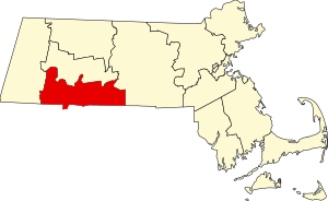
 Location within the U.S. state of Massachusetts | |
 Massachusetts's location within the U.S. | |
| Coordinates: 42°07′39″N 72°34′17″W / 42.12756°N 72.571312°W | |
| Country | |
| State | |
| Founded | 1 August 1812 |
| Named for | John Hampden |
| Seat | Springfield |
| Largest city | Springfield |
| Area | |
| • Total | 634 sq mi (1,640 km2) |
| • Land | 617 sq mi (1,600 km2) |
| • Water | 17 sq mi (40 km2) 2.7% |
| Population (2020) | |
| • Total | 465,825 |
| • Density | 755/sq mi (292/km2) |
| Time zone | UTC−5 (Eastern) |
| • Summer (DST) | UTC−4 (EDT) |
| Congressional districts | 1st, 2nd |
Hampden County is a non-governmental county located in the Pioneer Valley of the U.S. state of Massachusetts, in the United States. As of the 2020 census, Hampden County's population was 465,825. Its traditional county seat is Springfield,[1] the Connecticut River Valley's largest city, and economic and cultural capital; with an estimated population of 154,758, approximately one-third of Hampden County residents live in Springfield.
- ^ "Find a County". National Association of Counties. Retrieved June 7, 2011.
